Mapping the Holy Land: The Foundation of a Scientific Cartography of Palestine, 1st Edition
In stock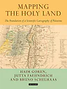
Mapping the Holy Land: The Foundation of a Scientific Cartography of Palestine, 1st Edition
$54.00
Mapping the Holy Land provides a unique study of the cartography of the Holy Land during the formative period of its development.
Through a detailed study of the work of three of the leading figures of the era - Augustus Petermann, Physical Geographer Royal to Queen Victoria; cartographer Charles Meredith van de Velde, who produced the finest map of the region at the time; and Edward Robinson, founder of modern Palestinology - the authors explore the complex cultural, cartographic and technical processes that shaped and determined the resulting maps of the region.
Making full use of newly discovered archival material, and richly illustrated in both colour and black and white, Mapping the Holy Land is essential reading for cartographers, historical geographers, historians of mapmaking, and for all those with an interest in the Holy Land and the history of Palestine. Tauris & Co Ltd.
Book Details
- Authors: Bruno Schelhaas, Jutta Faehndrich, Haim Goren
- Publisher: I.B
- Edition: 1st Edition
- eBook ISBN: 9780857729835, 0857729837
- Print ISBN: 9781784534547, 1784534544
Product Details
You May Also Like
View all →
Advances in Computer Science and Information Technology: First International Conference on Computer Science and Information Technology, CCSIT 2011, Bangalore, India, January 2-4, 2011. Proceedings, Part I
Designing Democracy Re-education and the America Houses (19451961)- The American Information Centers and their Involvement in Democratic: Re-education in Western Germany and West Berlin from 1945 to 1961

Advances in Neuroergonomics and Cognitive Engineering: Proceedings of the AHFE 2016 International Conference on Neuroergonomics and Cognitive Engineering, July 27-31, 2016, Walt Disney World®, Florida, USA